Modeling Tools
Software and modeling tools developed and maintained by the lab.
Transportation Modeling and Simulation
- Regional Network Model: Represents the Knoxville metropolitan road network, including interstates (I-40, I-75, I-140), U.S. highways, and major arterials.
- Demand Estimation: Estimates origin-destination (OD) travel demand using observed traffic count data.
- Traffic Assignment: Loads the estimated OD demand onto the network to estimate link-level traffic volumes.
- Congestion Assessment: Computes volume-to-capacity (V/C) ratios to identify corridors operating near or above capacity.
- Scenario Evaluation: Tests how demand growth, network changes, or operational strategies affect congestion across the region.
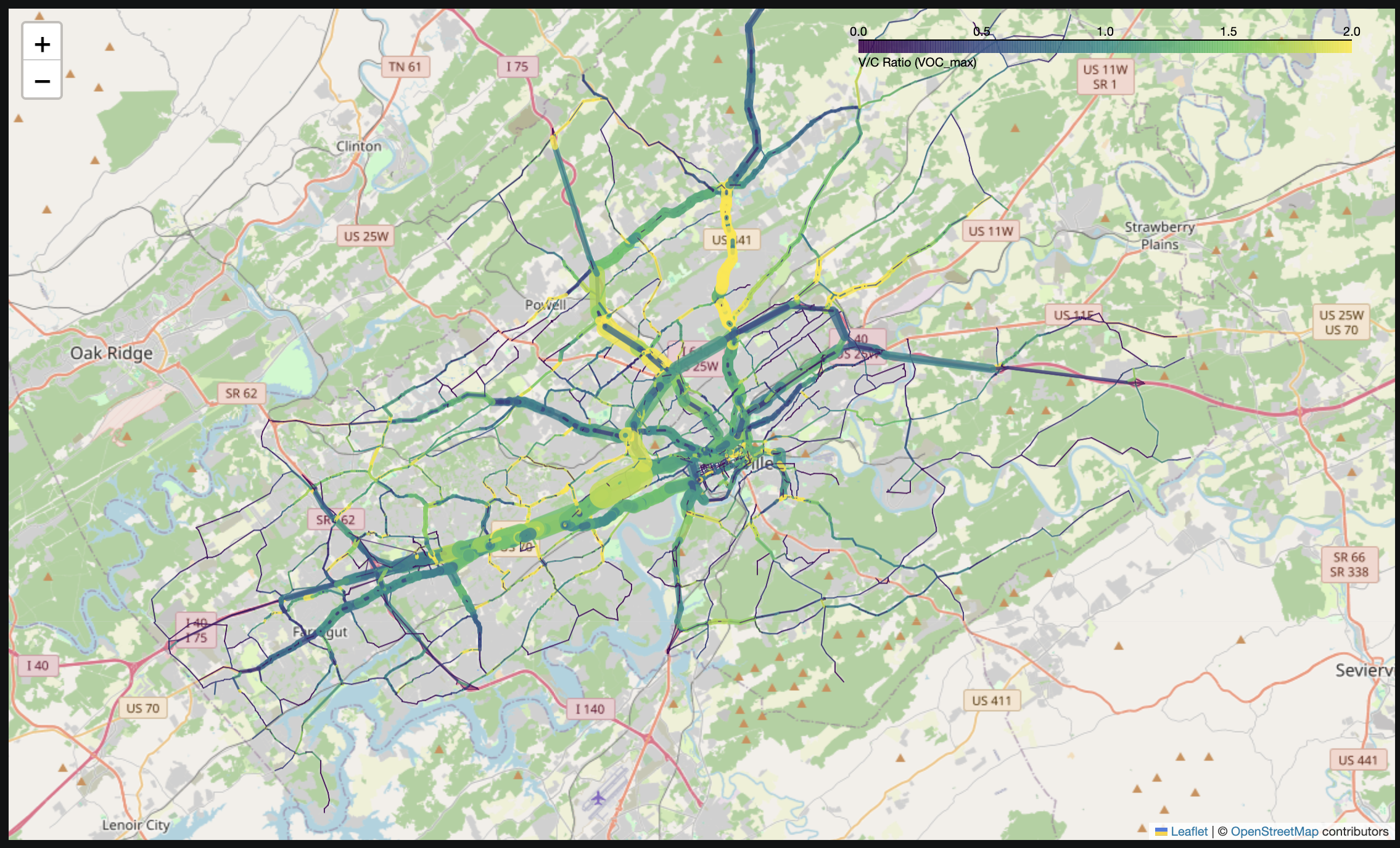
The map above shows simulated volume-to-capacity ratios across the Knoxville, Tennessee region. Congestion is concentrated along the I-40/I-75 corridor west of downtown and the northern approaches toward Powell and Halls, while outlying rural roads remain well under capacity.
Microhub and Electric Cargo Cycle Planning Tool
- Microhub Sizing: Estimates the number of microhubs required to serve the study area.
- Location Selection: Identifies optimal microhub locations.
- Service Area Assignment: Assigns service areas to microhubs.
- Fleet & Route Sizing: Calculates the number of e-cargo cycles required at each microhub and the total tour distance.
The demonstration above illustrates the application of the tool to New York City (NYC).
Tennessee Highway Incident Analysis
- Hotspot Analysis: Identifies locations with elevated incident concentration across the highway network.
- Incident Severity Modeling: Estimates the likely severity of incidents based on roadway and traffic conditions.
- Incident Clearance Time Modeling: Predicts how long it will take to clear an incident from the roadway.
- Scenario Analysis: Compares predicted incident severity and clearance time across different scenarios.
Highway Incident Analytics
Analyze highway incident data across Tennessee to uncover patterns, predict hotspots, and support data-driven safety and infrastructure decisions.
Open Titan →